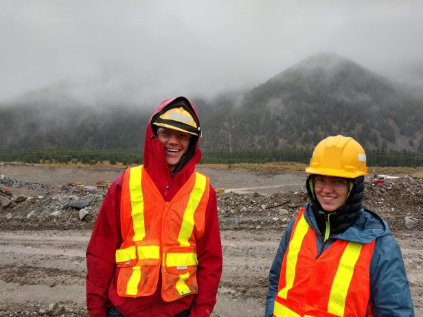
By Penelope Vorster, 2019 GeoCorps Participant
In the summer of 2018, I attended the National Speleological Society (NSS) annual convention in Helena, Montana, a large gathering of cavers, explorers, and scientists from the U.S. and beyond. I intended for this to be a vacation and a chance to expand into a larger caving community than the one I had grown up in at home in Virginia. I did not expect that a person I met by chance at that event would lead me to the doorstep of the GeoCorps program, or to a new life in Montana.
An unplanned travel schedule and a three-week window between the NSS Convention and the start of my final year of undergraduate studies at Mount Holyoke College allowed me to tag along with my new friend and then-GeoCorps participant, Jenna, to her cabin in Red Lodge and cool summer job hunting caves in the Pryor Mountains. After only a few days volunteering I was enamored of the landscape, the challenging fieldwork, and the objective to find new caves.
Less than a year later, I loaded up my car in Massachusetts, and hit the highway for Red Lodge, where I have had the pleasure of continuing the work that Jenna and the rest of the 2018 cave crew started.
Pryor Mountains cave management project:
I spent this summer as the GeoCorps Cave Management Specialist on a project jointly managed by the Beartooth District of the Custer Gallatin National Forest (CGNF) and the Billings Bureau of Land Management (BLM) Field Office. The bulk of our cave inventory and monitoring fieldwork took place in the Pryor Mountains, a karst landscape with lands administered by the CGNF and BLM, as well as by the Crow Reservation and private landowners. Though the three-person crew of which I was a part spent the majority of our time in the Pryors, opportunities to work in other areas were presented. Our crew carried out cave inventory and cave cartography projects in the Beartooth Mountains, assisted with petrified forest monitoring on the Gardiner Ranger District of the CGNF, and even became acquainted with mining operations on the forest, both those in the active stages of resource extraction and sites in the process of reclamation.
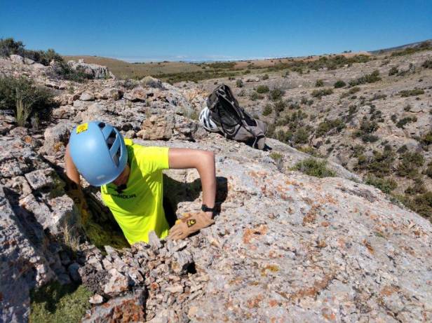
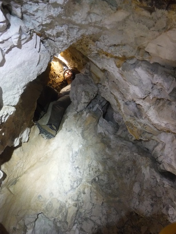
Our primary objective was to locate and collect data on unreported karst features and caves forming mostly in the Mississippian Madison Group Limestone of the Pryor Mountains, an area already known for several caves which provide bat habitat and opportunities for recreation. Daily activities included walking limestone outcrops to inspect openings in the rock and record information regarding the size, attributes, resources, and location of each karst feature. The data collected was then uploaded into a database containing known caves, the results of previous surveys.
Initially, our ridge-walking areas were informed by a helicopter flight over the area, which the supervisors of my project had completed several years earlier. This flight had helped to identify areas with high concentrations of visible void spaces in the limestone outcrops. While these areas had some promise, our crew found that looks can be deceiving, and after a few weeks of thorough searching in our priority areas, finding little but shallow alcoves, we gained enough familiarity with the geology and hydrology of this area to begin targeting areas outside of the initial scope of the project.

With a newly minted bachelor’s degree in geology and several years of caving experience under my belt, I was able to bring a few useful skills to this project. Experience with field data collection, geologic field mapping, and geoprocessing methods using ArcGIS, were applied to a dynamic planning strategy. As our crew determined a need to look outside of our initial target area, we spent many hours looking over topographic and geologic maps, hypothesizing on conditions of local speleogenesis, and determining where best to look next. Remaining flexible and changing the plan in light of new observations led to increased success toward the end of the season. We discovered three of the five caves nominated for significance within our last four weeks in the field.
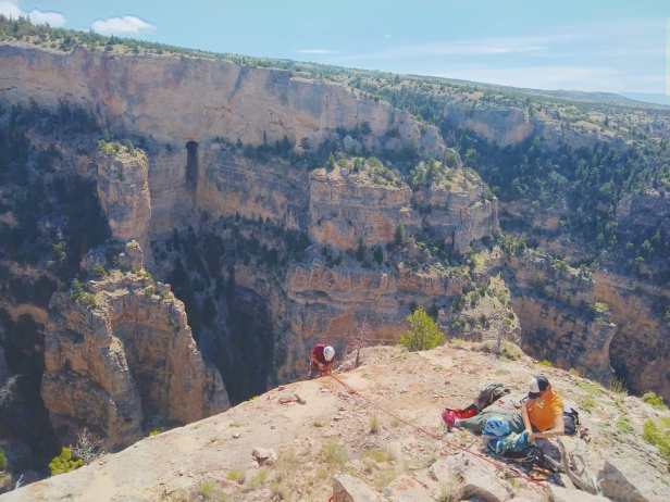
Access to potential caves was not always as straightforward as hiking in and out. In one case, an enticing opening high on a cliff face across a canyon from our access road demanded a technical approach. Setting anchors in the rock, rigging for vertical access, and rappelling over 400 feet into the canyon was our best approach. I came to the project competent with vertical caving, and expanded my knowledge as I learned to set anchors, rig ropes, and assist with a vertical rescue.
Managing the data
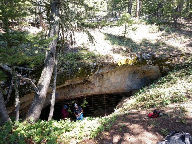
The results of our summer field work include over 150 newly documented karst features, all of which have been added to a database with their location, and information on their attributes and resources with respect to seven categories: biota, cultural, geologic/mineralogic/paleontologic, hydrologic, recreational, educational/scientific, or specially designated area. Fulfillment of criteria in one or more of these seven categories may be used to nominate a cave for the status of Significant Cave and ensure associated protections. Five of the caves our crew documented this summer have been nominated for significance.
The path to seamless data collection and integration into a database is long, and we spent a substantial amount of time this summer working with BLM geospatial specialists to develop and refine our data collection strategies. It is our hope that the changes we have made will help next year’s cave inventory group collect better data and build a more robust database. Additionally, the cave inventory form we collaborated on is one of several developed by various cave management teams on public lands. We currently communicate with the director of the National Cave and Karst Program and cave groups on the Salmon-Challis and Bridger-Teton National Forests, sharing and workshopping our inventory and management practices with a future national standard in mind.
Interactions with the public
Though our crew’s work usually did not involve interactions with the public, opportunities to meet with interested folks were some of the most rewarding. In one standout public interaction, I facilitated a trip to a now-gated cave in the Pryor Mountains for a group whose family has owned a ranch there for generations, and with whom the BLM has a valued partnership. This group had requested access to the cave during their family reunion on the ancestral ranch, and I was excited to be able to serve as a guide and educator. I led a small group of individuals, some of whom had visited the cave years before a gate was installed, all of whom had stories about their father or grandfather spending time in the area and exploring the cave in decades previous. Members of this trip were just as excited to learn about speleogenesis, cave mineral formation, and bat roosting habits as I was to hear tales of early exploration. The free exchange of stories in this small group helped me gain a better sense of the historical and recreational value these karst landscapes have for the public.
Moments above ground
In July, I had the opportunity to attend a celebration of the successful reclamation of the New World Mining District and removal of Soda Butte Creek from the list of Comprehensive Environmental Response, Compensation, and Liability Act (CERCLA/Superfund) sites. I spent the day in Cooke City, Montana touring the reclaimed mining sites, hearing about the long road to restoration as told by collaborators on the project from organizations including the U.S. Forest Service, National Park Service, Department of Environmental Quality, nonprofits, from and citizen scientists.
The scale of the project, the dedication of those working on reclamation, and the significance of the results to the surrounding community were inspiring, prompting me to begin learning as much as I can about the policies and procedures mentioned that day. I have taken every opportunity since then to attend mine tours, sit in on meetings regarding mining on public lands, and pick my supervisors and mentors’ brains to learn about mineral resource management. I had already become interested in topics related resource extraction, reclamation, environmental monitoring, and geochemistry while in my undergraduate program. These related experiences on the Forest have given me a focus to look toward as I make plans for graduate school.

Reflections
When applying for the GeoCorps position, I knew that I wanted to take this as an opportunity to learn what the possibilities are for a geoscientist to work on public lands. As a recent graduate, I was drawn to the idea that I could continue learning with a group of peers under the mentorship of our supervisor, while taking on a higher level of responsibility and becoming acquainted with a potential career track. I am grateful to my supervisors for their support, dedication to the project, and commitment to making this an enriching experience. I am grateful to my peers for freely sharing their skills, backgrounds, and ideas. I am thankful for the existence of the GeoCorps program, and for agencies that value the study and protection of cave environments.
###
Engage with your public lands over the summer and build your experience! 2020 Summer GeoCorps positions are now posted; the deadline to apply is 2 February.
