By Connor Dacey, GSA Science Policy Fellow
On 5 January 2021, the National Landslide Preparedness Act (H.R. 8810) became law. The bill authorizes funds for two primary purposes: to establish a National Landslide Hazards Reduction Program and a national 3D elevation program.
The bill calls for the establishment of the National Landslide Hazards Reduction Program within one year of becoming law. The program serves numerous functions, including to identify and understand landslide hazards and risks, reduce losses from landslides, protect communities at risk of landslides hazards, and improve communication and emergency preparedness. Activities part of this national program include identifying, mapping, assessing, and researching landslide hazards, responding to landslide events, establishing working groups with state offices, and developing landslide guidelines for geoscientists, emergency management personnel, and land-use decision-makers. The bill also calls for a publicly-available National Landslide Hazards Database to document landslide hazards, risks, and their impacts on health, the economy, and the environment.
This program will be the responsibility of a newly-created Interagency Coordinating Committee on Landslide Hazards that will oversee all aspects of the national program, including its strategy and mission. This committee will be comprised of the secretaries of multiple federal agencies and have no less than 11 members. One of the primary responsibilities of the committee is to produce a biennial report through the year 2030 that provides information on significant landslide events. This report will be published online and encompass information about the event, recommendations on how risk could be reduced, and a description of the effectiveness of any warning and risk communication. To complete the aforementioned tasks, the bill authorizes $25 million in funds for United States Geological Survey (USGS), $11 to the National Science Foundation, and $1 million to the National Oceanic and Atmospheric Administration each year from FY2021-2024.
The second primary purpose of the National Landslide Preparedness Act is to establish a national 3D elevation program. This program will coordinate and facilitate the collection, dissemination, and use of 3D elevation data among Federal departments and agencies and non-Federal entities, while also producing standard, publicly-accessible 3D elevation data products. A 3D Elevation Federal Interagency Coordinating Committee will oversee and manage this program. In addition, there will be the establishment of a subcommittee within the National Geospatial Advisory Committee comprised of individuals from research and academic institutions, local governments, and the private sector to assess trends and developments of 3D elevation data/program, while also preparing a report every two years to the Federal Interagency Coordinating Committee regarding updates, findings, and recommendations relating to the program. In total, the bill authorizes up to $40 million annually from FY2021-2024 to carry out these actions relating specifically to the 3D elevation program.
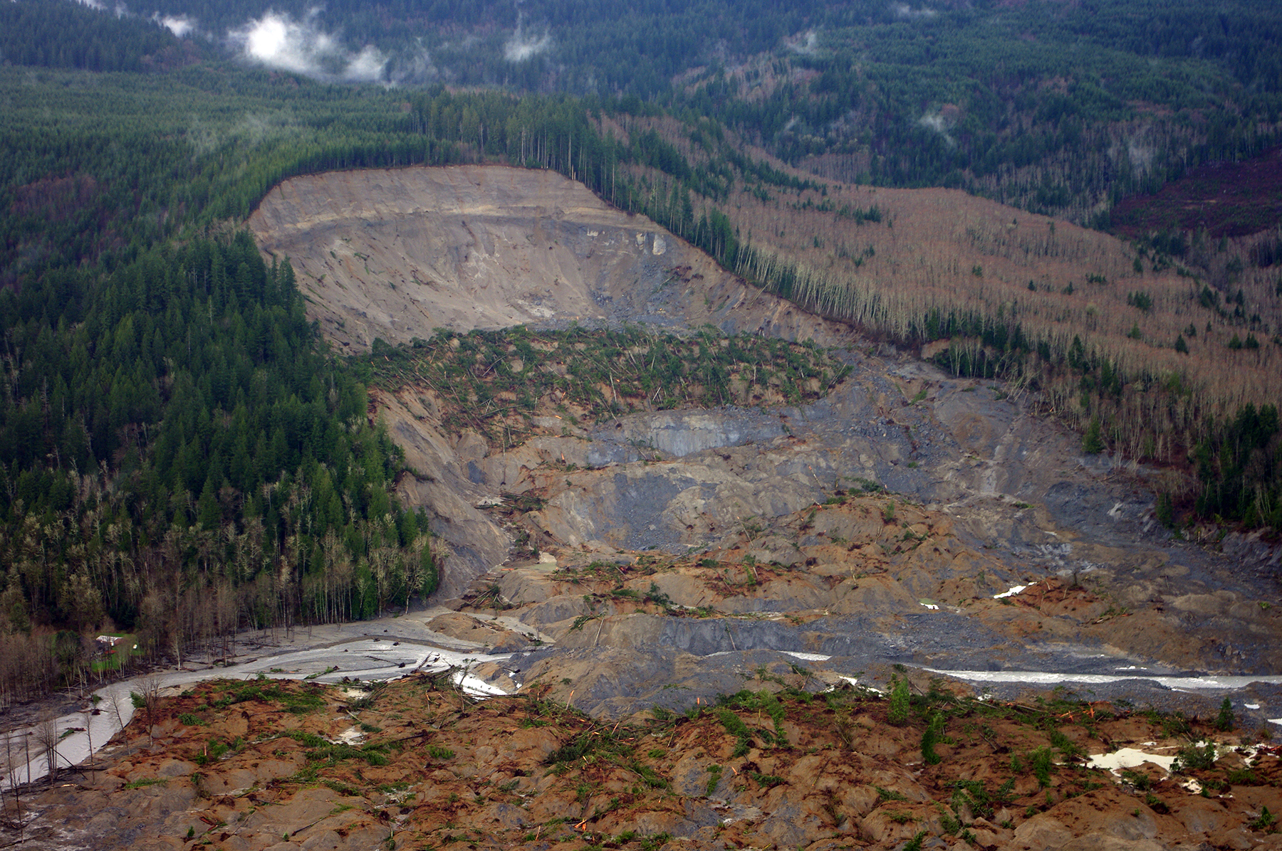
The passage of this bill comes at a unique time. Just a day before the U.S. House of Representatives passed the National Landscape Preparedness Act, multiple landslides, some as large as 600 feet across, ravaged Alaska. Overall, the U.S. is no stranger to landslides. According to the USGS, landslides occur in every state in the U.S. and they can cause up to $1 billion in damages and about 25-50 death each year. GSA actively supports landslide and natural hazard legislation, as emphasized by its position statements on Integrating Geoscience with Sustainable Land-Use Management and Improving Natural Hazards Policies through Geoscience. In fact, in early 2019, GSA cosponsored a congressional briefing with the Hazards Caucus Alliance focused on landslide science, risks, and mitigation efforts.
GSA hopes that the passing of the National Landslide Preparedness Act into law will ultimately help protect communities like those in Alaska from future landslides.
###

It is a monumental victory to support initiatives related to landslide-induced phenomena. These events are already causing havoc in many countries. The increased frequency of landslides due to both natural and anthropogenic-related reasons needs to be understood from both geological and meteorological point of view. With an alarming rate of forest fire, deforestation, extreme weather-related situations, the prospect of recurrence of mega landslides are becoming a reality. Information gathered from a variety of sources will be extremely useful to predict and undertake necessary steps to minimize the potential dangers and adverse impacts due to a landslide. An emphasis on the role of citizen science and proper communication will certainly aid emergency preparedness. Geologists can play a dominant role in this context by disseminating critical information to the inter-governmental and city agencies, urban planners, and elected officials.