This blog post hits some of the topics in the GSA Pardee Session “Earth as a Big Data Puzzle: Advancing the Information Frontiers in Geoscience”. The session is a mix of lightning talks and demonstrations: 1:30 – 5:30 p.m., Sunday, November 4, 2018, Poster Hall J-K, Indianapolis Convention Center. Please join us!
By Leslie Hsu and Anders Noren
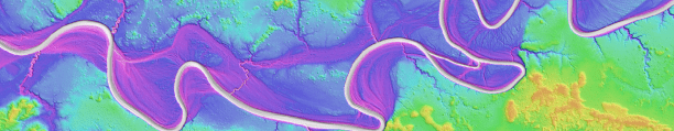
What does your data look like? Is it a virtual pile of numbered versions of spreadsheets? Is it a collection of points, lines, and polygons on a digital map? Is it four dimensional? Was it carefully recorded into a field notebook then later digitized? Is it video footage? Model output? Sensor data? Measurements made on physical samples?
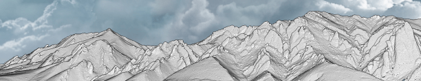
The geosciences has a stunning diversity of data types. The tools and methods for analyzing, managing, and delivering that data changes rapidly. As soon as you receive your degree, a new set of tools, apps, and information sources becomes available. Keeping up with the latest tools and practices across the geosciences is a challenge we all face.
No matter what our data look like, or how we analyze them, we want to maximize their value and efficiently draw the best scientific conclusions from them, and to add to the knowledgebase of the geoscience discipline. Geoinformatics is a field that helps to transform data to knowledge in the geosciences (Sinha et al., 2010).
The GSA Geoinformatics Division, established in 2006, promotes activities that emphasize technology-supported discovery and integration of data, leading to a better understanding of Earth and the planets. Members’ diverse interests include machine learning, rescuing legacy data, geographic information systems, and data visualization.
At the upcoming Annual Meeting, some of the sessions we are sponsoring include Geoscience Apps on the Web and in Your Hand, FAIR Data – What Can Geoinformatics Do?, and the Pardee Symposium Earth As a Big Data Puzzle: Advancing Information Frontiers in Geoscience.
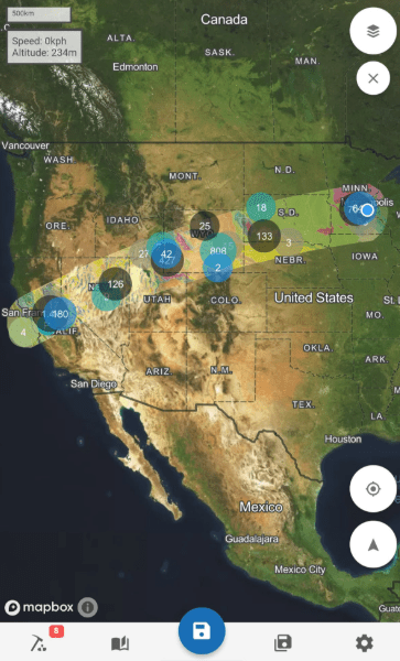
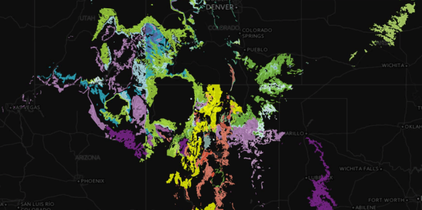
The Pardee Symposium was designed to bring user-ready tools to a broad GSA audience. The 18 speakers must deliver an extremely short, non-technical presentation that highlights the most important aspects of their application or project. In addition to these lightning talks, part of the session is devoted to poster and demonstration discussions, so you can dive deeper into topics with the speakers. There will be presentations on tools for working with stratigraphic, geologic, paleobiological, geochemical, structural, elevation, surface process model, hydrologic, and environmental data.
So, no matter what your data looks like, we hope you’ll bring them with you to check out the GSA Geoinformatics Division and our activities at the Annual Meeting in Indianapolis.
 Leslie Hsu is the Coordinator of the Community for Data Integration at the U.S. Geological Survey. Leslie is currently serving as the 2017-2018 Chair of the Geoinformatics Division of GSA. She received her MS in Geosciences from the University of Arizona and her PhD in Earth & Planetary Science from UC, Berkeley. Leslie’s interests include fluvial seismology, debris flow erosion, use of new technologies in geoscience research, and facilitation of communities of practice.

Anders Noren is the Director at the Continental Scientific Drilling Coordination Office, University of Minnesota. Anders has served as the 2016-2018 Secretary-Treasurer of the Geoinformatics Division of GSA, and is the 2018-2020 Secretary-Treasurer of the Continental Scientific Drilling Division of GSA. He received his BA in Geology from Carleton College and his MS in Geology from the University of Vermont.
Reference
Sinha, A.K., Malik, Z., Rezgui, A., Barnes, C.G., Lin, K., Heiken, G., Thomas, W.A., Gundersen, L.C., Raskin, R., Jackson, I. and Fox, P., 2010. Geoinformatics: transforming data to knowledge for geosciences. GSA Today, 20(12), pp.4-10.
###
