by Amy Atwater
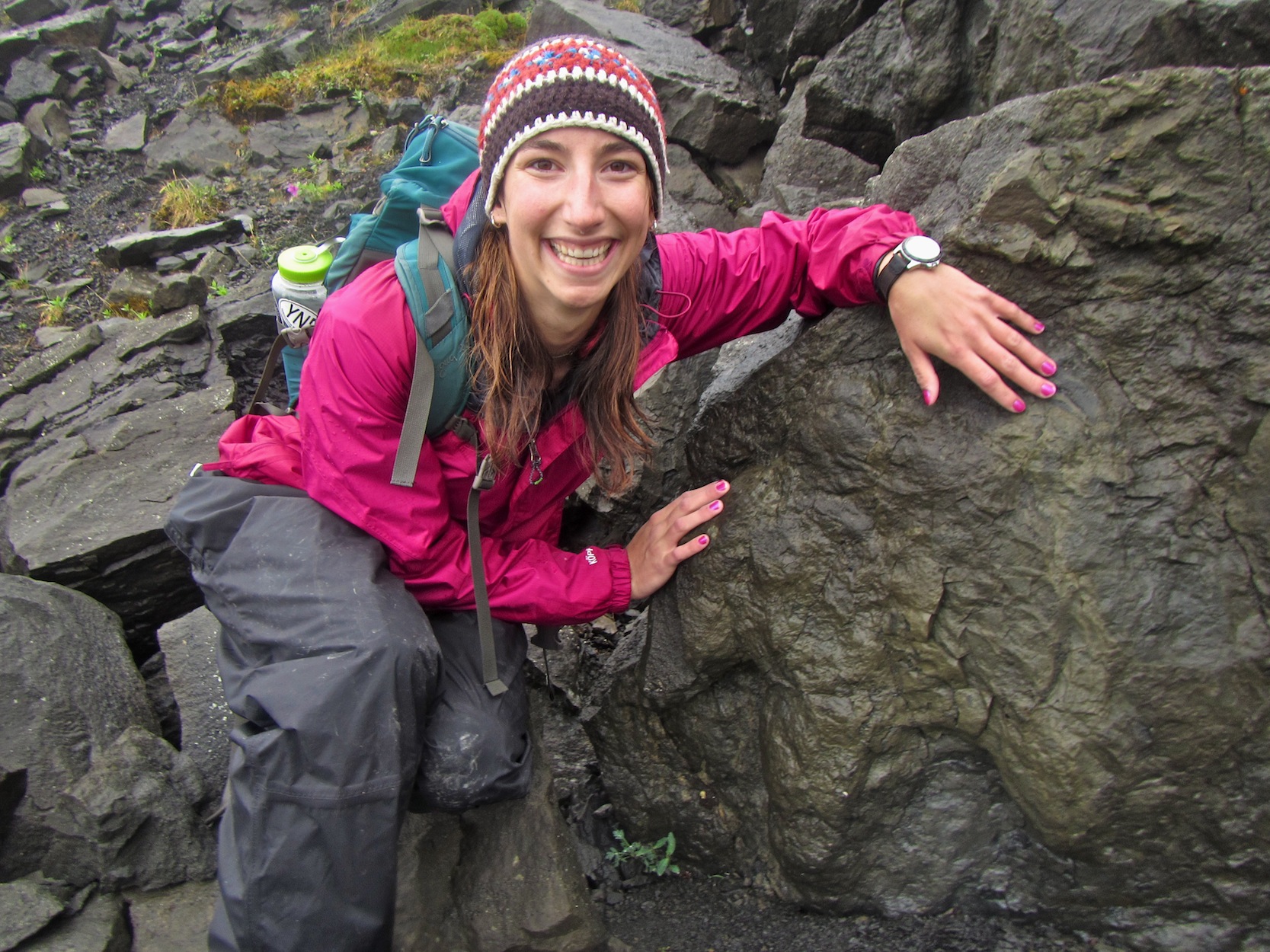
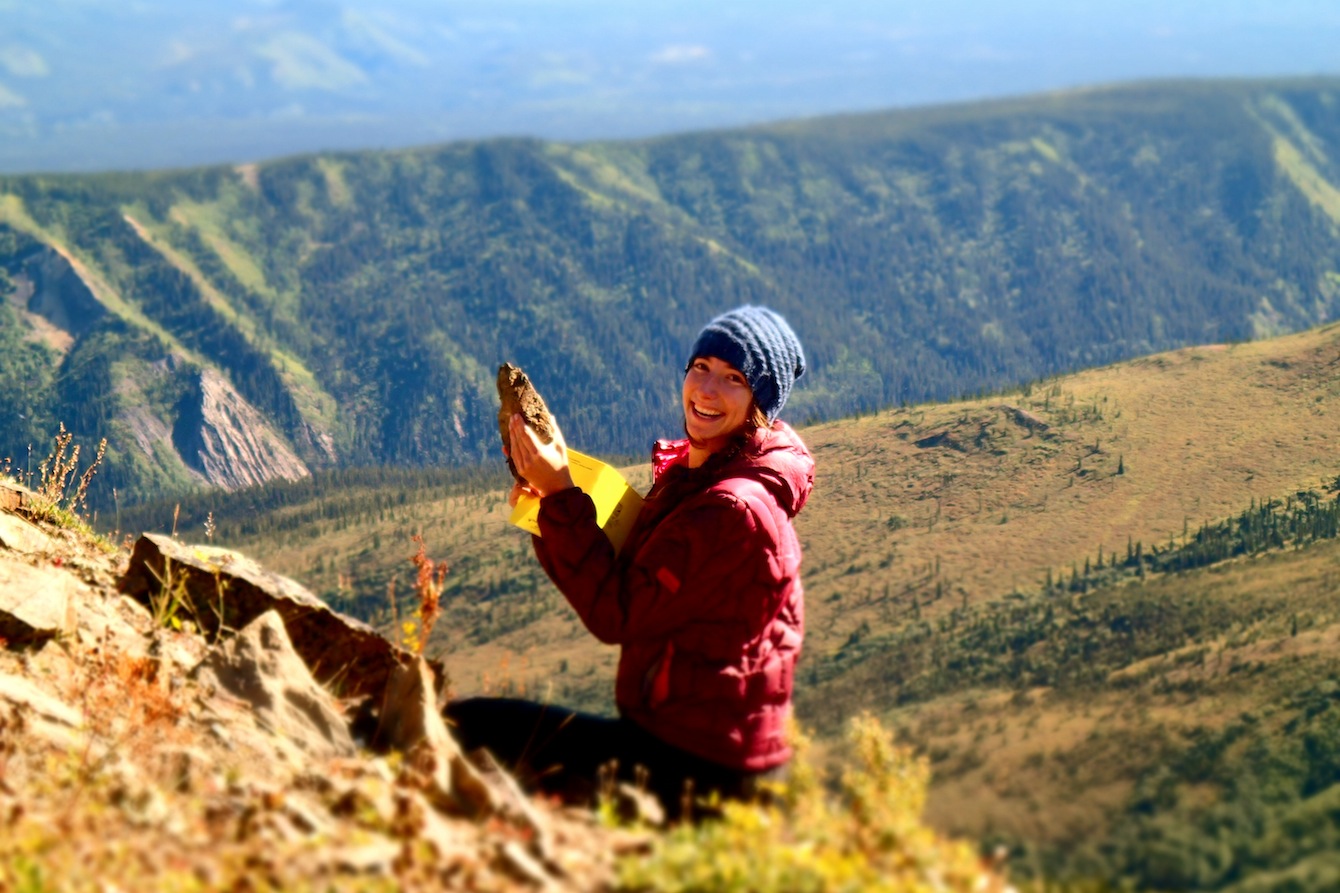
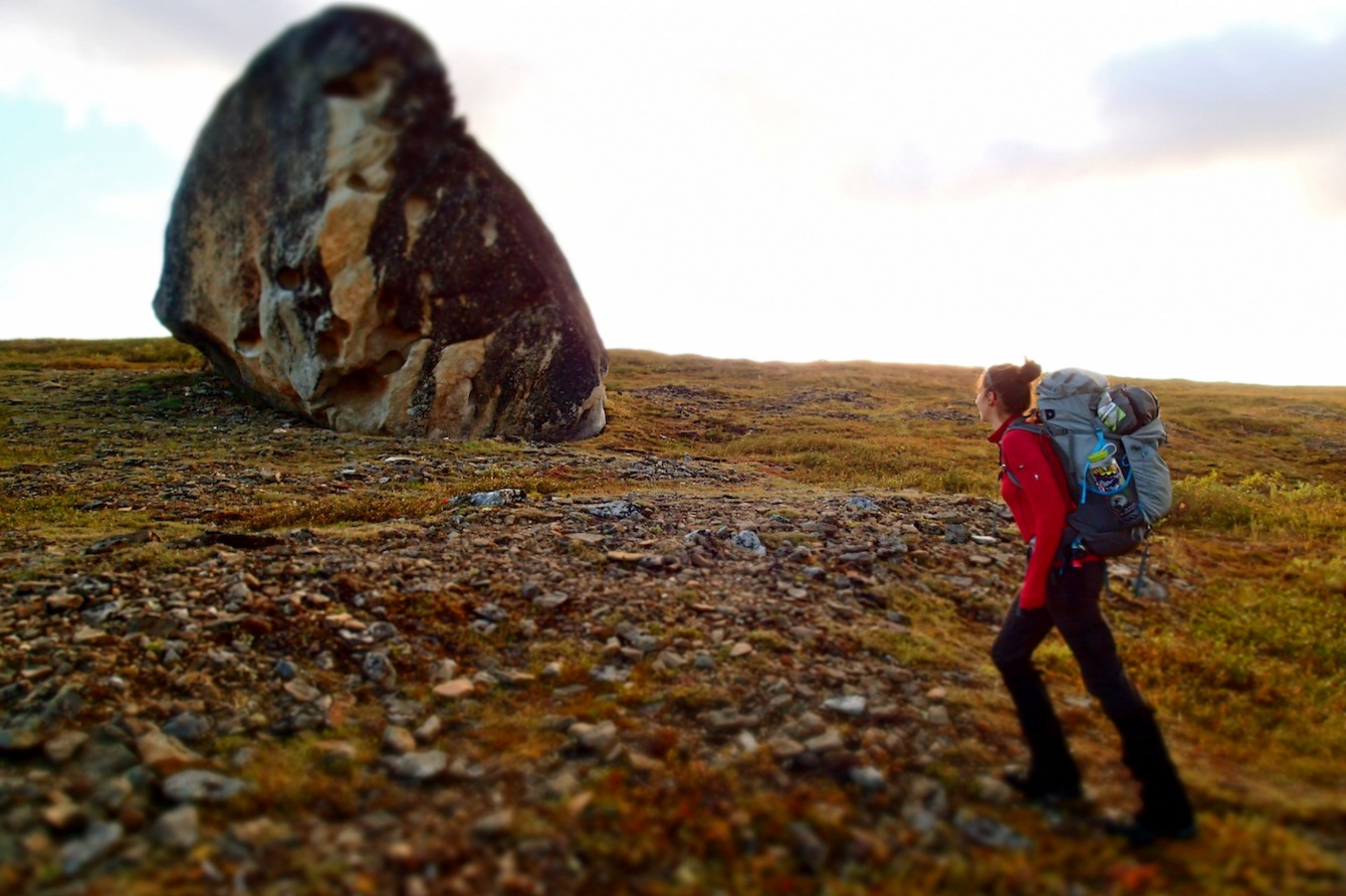
I first heard about the GeoCorps™ America program from my good friend and long-time mentor, Ted Fremd. He told me all about the program, but mostly about the geology. “Just miles and miles of unexplored land,” he said, “and the helicopters reveal the most spectacular sights you’ve ever seen!” I was a sophomore at the University of Oregon at that time, just discovering my love of field geology. Maybe Ted didn’t know what he was starting when he told me about the “hundreds of dinosaur tracks in Denali… and the best locality is in a part of the park they call ‘grizzly valley’ where the paleontologists are accompanied by rangers with shotguns on bear patrol!” Then again, maybe he knew exactly what he was doing because two years later I found myself standing by a field vehicle in Denali National Park and Preserve at Tattler Creek, one of the more spectacular fossil localities within the park.
It’s late July, and I have been working as a GeoCorps Paleontology participant at the park since late May. Ted by this point had assured me he had been exaggerating those years earlier, telling me via email that “by now you’ve figured out I was pulling your leg about the trackway area being ‘The Valley of the Bears.’” Up to that point this had proven to be true: Two full months in the park with no bear encounters in the backcountry. This day at Tattler had been very special, we had returned to the locality with research paleontologists Dr. Tony Fiorillo, Dr. Yoshitsuga Kobayashi, and Dr. Yuong-Nam Lee. We had our most productive day in the park, documenting over seven new localities and helping Dr. Fiorillo prepare molds of the more significant dinosaur tracks. As we returned to the vehicles and started putting our packs away someone suddenly yelled “BEAR!” as a sow grizzly and her two year-old cubs rambled up through the alders. Before I knew it the three bears were suddenly on the other side of the car from myself and the six other researchers. We started yelling, hollering and joining together in a large group to appear larger. As they walked around the cars I was only a few yards from these massive mammals; I had my bear spray in hand, with the safety switch off for the first time ever. The young cubs were curious about these screaming primates, but momma bear couldn’t have cared less about our presence and soon they wandered down the road. I was shaking, my heart pounding, and I was completely enthralled by the experience. By the time my field season was over I’d logged over a dozen grizzly bear sightings within that one drainage; so much for pulling my leg about ‘The Valley of the Bears,’ huh Ted! Bears, grueling fieldwork, biting mosquitoes, and soggy boots are all part of the life of a Denali National Park GeoCorps Participant.
GeoCorps Project
The discovery of dinosaur tracks in Denali in 2005 sparked paleontological investigations in the Cantwell Formation. This formation is a late Cretaceous fluvial deposit that records dinosaur tracks, plant fossils, and invertebrate fossils. In Denali the formation includes a variety of rock types such as conglomerates, sandstones, siltstones, and shales. The rocks within the Cantwell Formation indicate that the paleoenvironment was diverse with river channels, lakes and ponds, ancient floodplains and alluvial fans (Tomsich et al. 2010). The plant fossils indicate that the late Cretaceous in this part of Alaska was rich with deciduous trees and conifers as well as ferns, horsetails, and shrubs. The paleoflora, along with the recent discovery of dinosaur tracks, bird footprints, and diverse invertebrate trace fossils indicate the Cantwell was a flourishing terrestrial ecosystem in a high-latitude environment (Fiorillo et al. 2007). The paleo-climate has been reconstructed as temperate, with warmer summers and winters than current conditions in Denali (Tomsich et al. 2010).
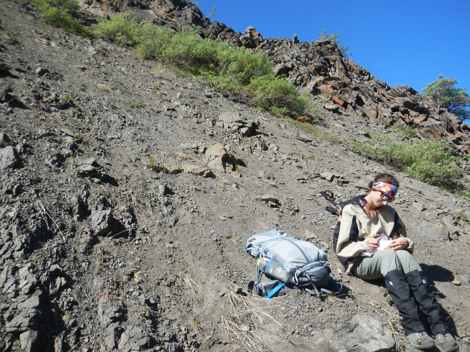
Since the discovery of dinosaur tracks, GeoCorps Participants have documented dozens of new fossil sites, created interactive maps with rich attributes, and maintained a database for the park’s paleontological resources. The database has allowed outside researchers and new Participants to identify existing resources and plan projects in an easy-to-use format. Denali National Park and Preserve covers over six-million acres, and the area that contains the dinosaur fossils is both large and difficult to access. This creates a need for a technique to assess the likelihood of finding vertebrate fossils in a given area without sending researchers into the field. Fossil locality discovery has traditionally resulted from guesswork and from extensive field surveys. I decided that for my GeoCorps project I wanted to create a vertebrate fossil site suitability analysis for Denali in ArcGIS, utilizing newly available remotely-sensed imagery and the park’s recently expanded paleontological database. Such a prediction model would help us address the challenges of fossil site identification within Denali.
Project Data
In order to determine the best potential dinosaur track fossil sites in Denali, I created a model using raster layers and the ArcGIS Spatial Analyst tool. This model takes into account geospatial attributes from known fossil localities within the park and produces a map that highlights other regions within the park with similar attributes. The hope is to save time and resources by expediting the time it takes to locate new fossil sites.
Many environmental attributes influence fossil site location and accessibility. Geospatial factors that are regarded as useful for finding vertebrate fossils within the Cantwell Formation were analyzed and ranked on a scale from 1 to 4, with 4 representing the best score for finding fossils. I identified the three most significant geospatial factors in vertebrate fossil sites within the Cantwell Formation to be vegetation coverage, slope, and presence of landslides. To determine the relative ranking of importance of these factors, I first analyzed the characteristics of the known vertebrate fossil localities. Geologic maps were used to determine the extent of the Cantwell Formation within the park. Digital elevation models (DEM) at 30 m resolution were used to determine the slope of the fossil localities. Vegetation cover data was recorded from the Alaska National Land Cover Database 2001. All the data was gathered from the Alaska Region National Park Service “Alaska Pak” on ArcMap 10.1. I then determined the ranking scale of 1-4 for each geospatial variable by calculating the quartiles for the data. In statistics, the quartiles of a ranked set of values represent the three points that divide the data set into four equal groups. Each of these groups comprises a quarter of the total data (Zar 2010). This method allowed us to understand what values for the geospatial data are more closely associated with vertebrate fossil localities.
At first the data layers were simply added to GIS software (ArcGIS 10.1) and visually examined for similarities and obvious relationships. The next step was to reclassify the data into numerical representations of the attributes based on the likelihood of finding dinosaur fossils. The geospatial data was then entered into the Raster Calculator, another tool from the Spatial Analyst toolbar on ArcGIS 10.1. These processed data layers were added to the Raster Calculator using the suitability analysis procedure outlined in Wayne 2003a,b. In the future we hope to add “presence of landslide” as one of the environmental factors taken into account by the suitability analysis but time did not allow for the completion of a necessary landslide layer.
Results
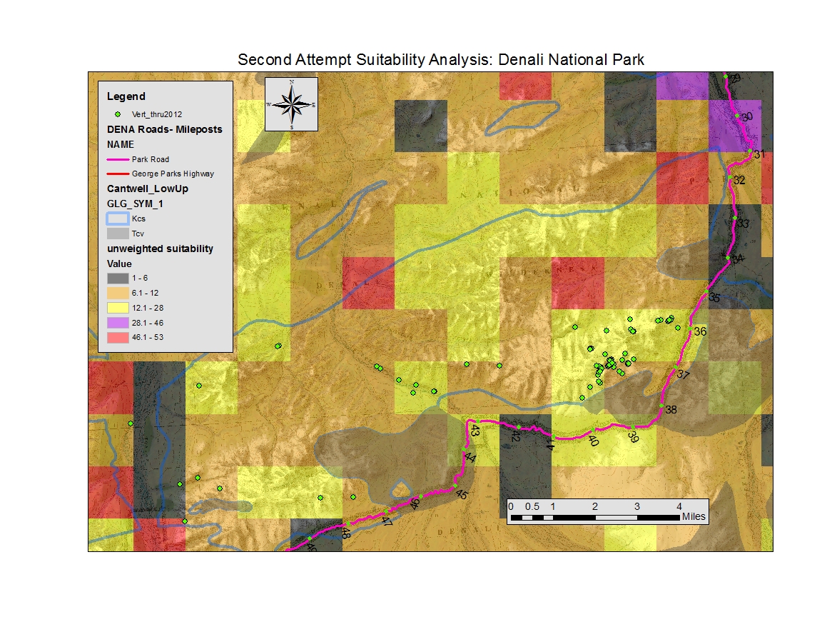
Initial attempts with the suitability analysis were rough and imprecise. The first model took into account slope, aspect, and vegetation cover and in this version all the variables were weighted equally, see Figure 4. The next version produced used slope, aspect vegetation coverage, and precipitation data. These factors were weighted equally to produce the map seen in Figure 5. This version was vague and blocky due to the precipitation data, which varied only slightly throughout the park. Upon consultation with others in the group we decided to eliminate the precipitation data because there does not seem to be any difference in fossil abundance based on precipitation within Denali.
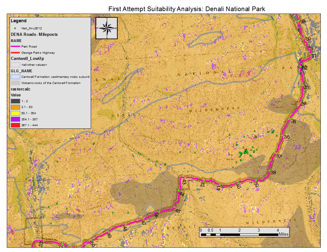
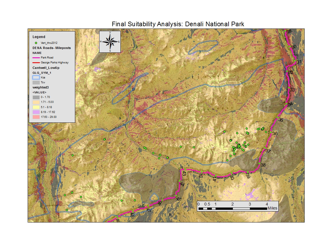
The final suitability analysis completed during the 2013 field season can be seen in Figure 6. This analysis took into account slope and vegetation coverage. Multiple rounds of guess-and-check as well as many group discussions led to the decision to exclude aspect and precipitation data. The final equation used to create the model was:
[Suitability Analysis] = ((vegetation coverage*0.6) + (slope*0.4))*2
Vegetation coverage was weighted higher than slope because it was agreed that this was the most important factor in finding fossil sites in the park and the digital data was the most up to date for the vegetation coverage (Capps & Fiorillo personal communications 2013).
The 2013 field season initiated the suitability model and subsequent field-testing of the final model. Approximately twelve dinosaur track localities were found in the Cantwell this summer. Many of the sites were from previously visited areas that had not been fully examined for fossil tracks. These sites do not help understand the precision of the model since their location was already known, but the geospatial data from these sites will help refine the model. Possible errors could stem from the GPS and it’s +/- values. Errors could also result human judgment such as calling a site in situ and counted for the study even though the fossils were not in their original location. The suitability analysis will be put to the test for future field seasons in Denali. Testing the model for accuracy is necessary in order to refine the model and determine the accuracy of the digital data used based on actual environmental conditions in the field.
Discussion/Project Conclusions
Analysis of the model indicates areas of low fossil density, moderate, and high fossil density. Though these different zones were visible on the map, most of our known fossil sites are within areas ranked relatively low on the density scale. This indicates that the model is indeed predicting areas of fossil sites, but is not accurate enough at this time to distinguish between areas of differing densities.
Continued field-testing will allow us to refine the model, defining areas of high, medium, and low site density. This will require additional testing and data collecting by future GeoCorps Participants. Other future work includes the completion of a landslide suitability analysis. The park geologist, Denny Capps, has noted that many of the best track sites in the park are in the scarps of recent mass wasting events. Once we identify landslide locations within the Cantwell Formation we can add “presence to landslide” as a factor in the fossil site suitability analysis and refine the model to predict fossil sites that occur within or nearby landslides. This suitability analysis will save government resources and reduce the exposure of researchers to the many hazards associated with the Denali backcountry.
The 2013 Denali Geocorps season was a great success. I managed to complete the first draft of a suitability analysis for the Cantwell Formation within Denali National Park and Preserve that will be refined and improved through future seasons of fieldwork and analysis. This analysis will help better inform scientists about the location of fossil sites within the park, which will save the park and the federal government time and resources. This method will also help keep park employees safe because fieldwork in the park can be extremely dangerous, especially at some of the more remote localities.
For more information on my GeoCorps project (and others), please stop by and visit my poster in Session T113 on Tuesday 29 October at the GSA Annual Meeting in Denver!
Reflections on my GeoCorps Experience
My GeoCorps project was just the beginning of my experiences at Denali. I was also lucky enough to be able to contribute to teaching materials and educational presentations at the Murie Science and Learning Center. I was the “local dinosaur expert” and also created multiple carved blocks to demonstrate the formation of dinosaur tracks to park visitors. The 2013 team identified 22 new fossil localities within the park, including 14 new vertebrate localities. We expanded the park’s knowledge of the paleontological resources and we also helped the research of visiting scientist Dr. Anthony Fiorillo. He and his team were in the park for about two weeks, and we joined him for two days in Tattler Creek and North Sable Mountain. We aided his team with the discovery of many significant sites, many of which were selected for molding. We found, identified and helped mold two therizinosaur tracks, one theropod track, a bird track, and a possible ankylosaur track. Not only did I get to work with a professional paleontologist, one considered the global expert on arctic dinosaurs, but my time with GeoCorps also led to the following:
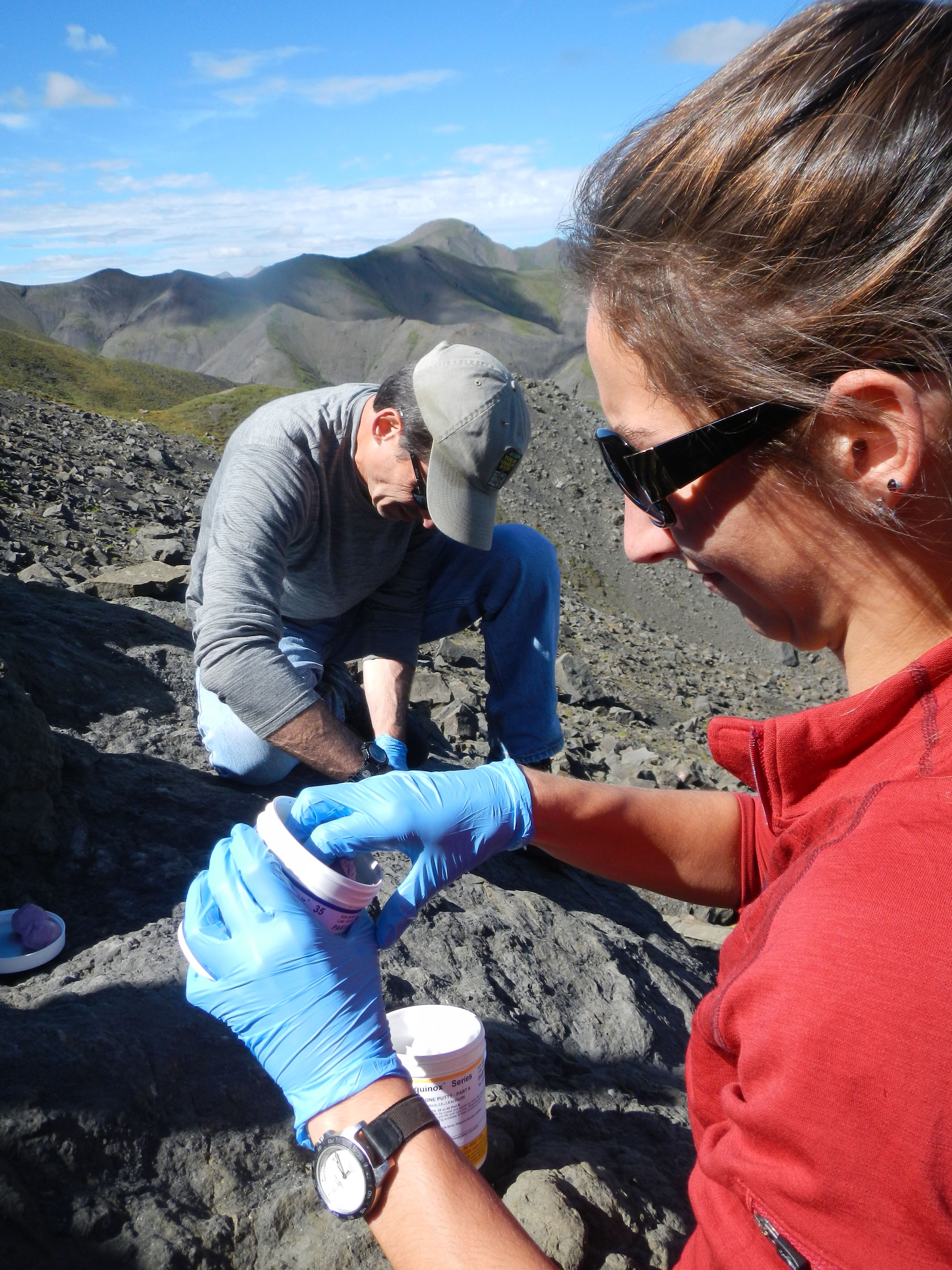
- Incredible networking opportunities! I spent an awesome day defleshing red squirrels with Dr. Link Olsen from University of Alaska Fairbanks and later met with Dr. Pat Druckenmiller in Fairbanks at the Museum of the North to discuss grad school possibilities.

Figure 8: Assisting Dr. Link Olsen from UAF. - Real work experience. The GeoCorps position will look great on a resume since I worked on a project full-time for 12 weeks and had an official title.
- Foot in the door with the National Park Service. I am now working at Denali as an emergency hire Physical Science Technician! Though this job will last a maximum of 60 days it sure is nice to get a paycheck and to be in a great position to secure other government jobs.
- Living and recreating in one of the most beautiful places on earth for 6 months. I saw bears, moose, caribou, foxes, porcupines, and lynx. I hiked through miles of muskeg and battled millions of mosquitoes. I picked buckets of blueberries and had more fun than I knew was possible.
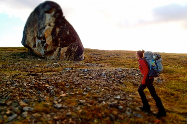
Figure 9: Denali National Park and Preserve; one of the most beautiful places on earth! - Publications. I was working on original research based on the park’s paleontology that I will be submitting to journals for publications. My time as a GeoCorps Participant also gave me great material for my blog about being a lady scientist, for a contribution to the Huffington Post’s ‘Girls in STEM’ series, as well as a chance to write for GSA!
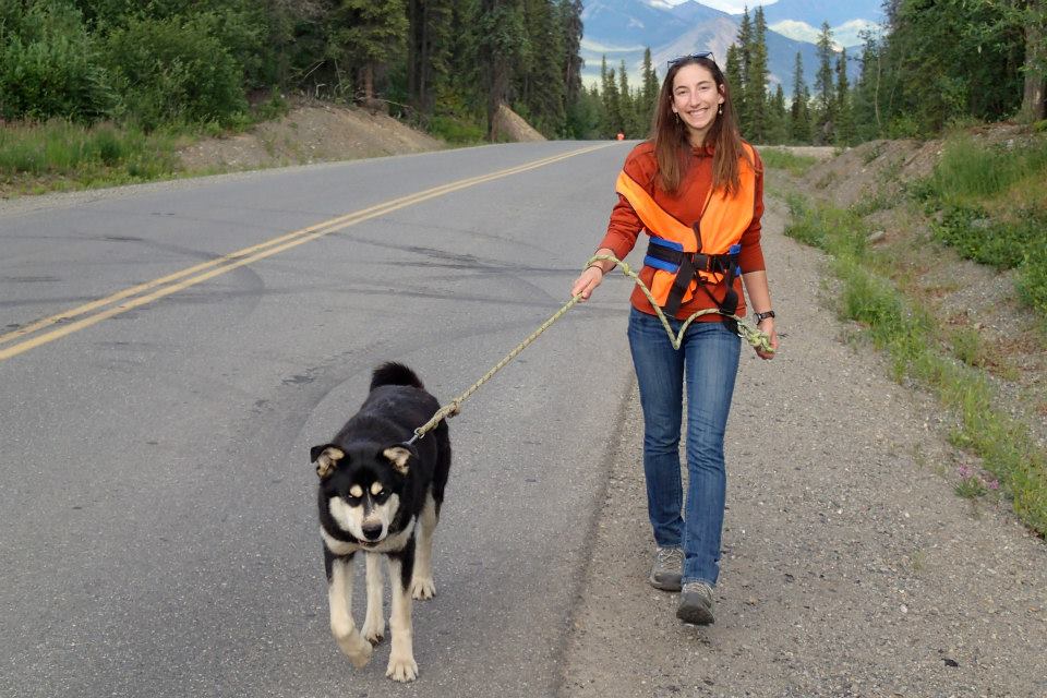
- Making lifelong friends, human and furry.

Figure 10: Author walking Lava, an official Denali sled dog.
All in all I would say that GeoCorps didn’t turn out like I expected, it was better. I found that the aspects of the job I was looking forward to the most didn’t exactly turn out how I had thought, but other aspects of the job went beyond any expectation. We weren’t able to complete as much fieldwork as I had originally hoped because of weather, water, and scheduling issues, but I am eager to continue to explore the park in future summers. GeoCorps is difficult but extremely rewarding; you learn a lot about yourself, other people, and life in the federal government. You have to have a positive attitude to success because things don’t always go how you would like but if you can roll with the punches and focus on the bright side, I guarantee that you will have the time of your life.
Works Cited
Fiorillo, A. R., Hasiotis, S. T., Kobayashi, Y., & Tomsich, C. S. (2009). A pterosaur manus track from Denali National Park, Alaska Range, Alaska, United States. Palaios, 24(7), 466-472.
Malczewski, J. (1999). GIS and multicriteria decision analysis. John Wiley & Sons.
Oheim, K. B. (2007). Fossil site prediction using geographic information systems (GIS) and suitability analysis: The Two Medicine Formation, MT, a test case. Palaeogeography, Palaeoclimatology, Palaeoecology, 251(3), 354-365.
Tomsich, C. S., McCarthy, P. J., Fowell, S. J., & Sunderlin, D. (2010). Paleofloristic and paleoenvironmental information from a Late Cretaceous (Maastrichtian) flora of the lower Cantwell Formation near Sable Mountain, Denali National Park, Alaska. Palaeogeography, Palaeoclimatology, Palaeoecology, 295(3), 389-408.
Wayne, C. (2003). Suitability analysis with raster data. ArcUser April-June, 6(2), 54-57.

This is fantastic. You blended field geology aspects with classroom knowledge and provided greater insight about various geological phenomena that can only be appreciated and fully understood in field setting. Superb narrative. Congratulations.